
History
Owing to its strategic position at the centre of the Balkan Peninsula, Kosovo has always been an important through-road and attractive spoil for its conquerors. Packed into a relatively small place, Kosovo has breathtakingly beautiful mountain peaks, waterfalls and wildflower meadows, fascinating cultural treasures, Ottoman-era buildings, traditional stone houses, churches, mosques, tekkes and medieval fresco paintings. There are rivers for fishing, lakes for swimming and fabulous walking and mountain-biking trails.
The best thing about Kosovo-you will quickly agree-is the people you meet who make travelling in this country so special. The biggest source of pride for a Kosovar family is to host a guest and to offer a warm welcome. (Bradt Travel Guide).

Discovering Western Kosovo
A pale stone bridge spans a narrow gorge. A snow-capped peak glows in the morning light. Bells ring from within a medieval monastery, and a muezzin’s call echoes from an ancient mosque. You’re in western Kosovo. Two decades after the end of war in the region, the doors have opened again on one of the most magical place in the world. Whether hiking wild Accursed Mountains, breathing the Ottoman atmosphere of Prizren or wandering the colourful Gjakova and Peja bazaars, visitor’s can’t help but marvel at the richness of culture and the vibrant weave of people, history, and nature in this crossroads of Europe and the Balkans.
Most of the visitors say that western Kosovo is a “true” Kosovo. Many of Kosovo’s best highlights are to be found here, including the Visoki Deqani monastery-Unesco World heritage site, founded 1327, Hadum Mosque-built 1594 by the architect Mimar Sinan (who also built at the same time Suleymanie Mosque, the largest one in Istanbul), Orthodox Patriarchate in Peja and Bajrakli Mosque, is the magnificent example of Ottoman architecture, and the traditional 18-th century stone kulla’s in Dranoc, Isniq and Junik. This region has always been a multi-cultural mosaic.
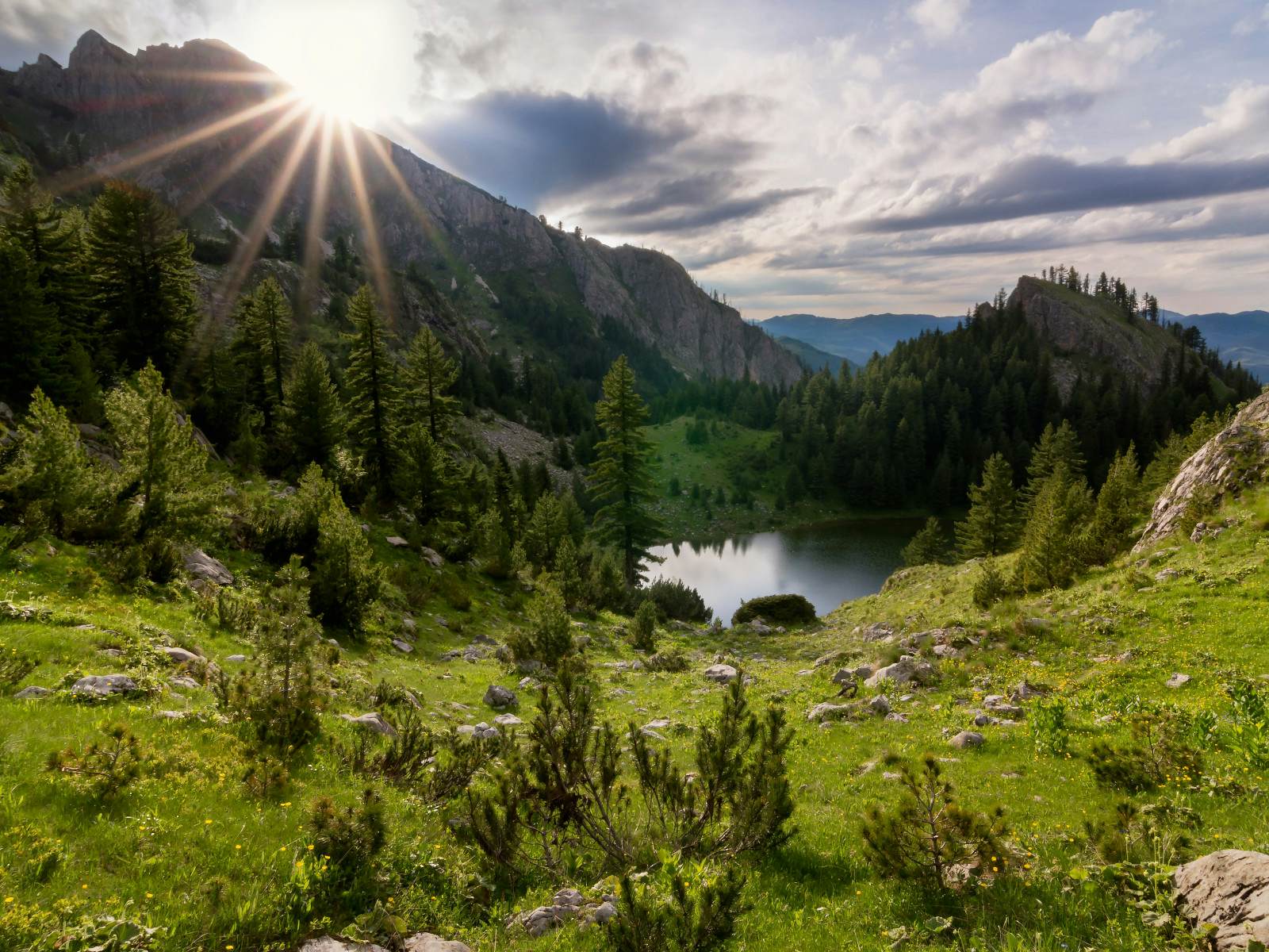
For passionate mountain lovers the region offers endless adventures from the “Bjeshket e Namuna” – “Accursed Mountains” (declared national park in 2012), at 2656m altitude, which are the southern part of Dinaric mountain range, with many peaks rising above 2000m, many glacial lakes, mountain rivers and springs, beautiful waterfalls, unexplored caves and attractive canyons. The best time to visit is from May to October, but for the snow lovers, Rugova mountain region, offers a great off-piste skiing & snowboarding, snowshoeing & hut to hut ski touring, and full Snow-Cat activities.
Explore
Kosovo has a surface area of 10,908km². It is surrounded by two great mountain ranges, Sharri mountains in the south as high as 2,000m on the Macedonian and Albanian border, and Accursed mountains range at the north west part, on the Albanian and Montenegro border.
The highest mountain is Gjeravica near Junik which is 2,656m and the lowest point is Vermicë in Prizren at 295m. Prishtina as a capital city lies at just over 600m. Around 41% of the cultivable land is forest. Crops grown include barley for the beer, some wheat, and vegetables (peppers, potatoes, carrots).
There are two main valleys – the Dukagjini Valley, which has better irrigation and is slightly warmer so is better for growing vegetables and vines, and the Kosovo Valley, which is good for potatoes and orchards in the southeast. Kosovo is unusual for a place of its size in being almost entirely self-sufficient in water. Its rivers run into the Aegean Sea, the Black Sea and the Adriatic sea. The main rivers in Kosovo are Drini i Bardhë (122km long) in the Peja region, Sitnica (90km), Bistrica e Pejës (62km), Morava e Binçës (60km) in the Gjilan area, Lepenci (53km) near Ferizaj and Kaçanik, Ereniku (51km) near Gjakova, Iber (42km) near Mitrovica and Bistrica e Prizrenit (31km) near Prizren. There are five big lakes: Battlava and Badovc reservoir which supplies capital Prishtina, Ujmanit lake in the north near Mitrovica, Radoniqi close to Gjakova and Vermicë on the border with Albania beyond Prizren.
The mountains are a mixture of glacial and volcanic in origin, with glacial lakes in the Sharr Mountains in Dragash and Brezovica and also in the Rugova and Deçan areas. Kosovo has a continental climate, with hot summers and cold winters. Snow can fall as early as November and as late as April. July and August are invariably hot, although May and June can be too. The night-time/daytime temperature differential is generally greatest in September and October.
.jpg)
- Area:
- 10,908 km2
- Highest point:
- Gjeravica 2,656m
- Population:
- 1.9 million (2020 estimate)
- Population density:
- 200 per km2
- Percentage of population under 27:
- 70%
- Ethnicities:
- Albanian 92%, Serb 4% and 4% other (including Bosnians, Turks, Roma, Ashkali, Gorani)
- Religions:
- Approximately 90% Muslim, 4% Serb Orthodox, Catholic 4%
- Capital city:
- Prishtina
- Population of capital city:
- 300,000 (2020 estimate)
- Other major cities:
- Peja, Prizren, Gjakova, Gjilan, Mitrovica, Ferizaj
- Official languages:
- Albanian, Serbian and, in the Prizren area: Turkish
- Currency:
- Euro
- Natural resources:
- Zinc, lead, silver, copper, lignite, kaolin, marble, chrome. magnesite, nickel and other.
- International telephone code:
- +383
